
Atlantic City ZIP Code Coverage
Atlantic City postal geography needs a source-and-date check. USPS delivery labels, city limits, wards, neighborhoods, county boundaries, and parcels serve different purposes. The official materials inspected support four local ZIP labels, but they do not create a complete address-by-address municipal map. Use the coverage below as a routing reference, then verify an individual address with USPS and compare it with a county parcel or tax source when the municipality matters.
| ZIP | Supported area or label | Post-office route | Directory caution |
|---|---|---|---|
| 08401 | Atlantic City standard-delivery label | Atlantic City Post Office at 1801 Atlantic Avenue | Verify each address with USPS |
| 08404 | Atlantic City postal or PO-box-style label in local materials | Current location or box-service field was not captured | Not a blanket parcel boundary |
| 08405 | Atlantic City-related postal material and changes | Current use needs USPS address-level verification | 2024 material reports realignment or deletion toward 08401 |
| 08406 | Material associated with Ventnor City | Nearby post-office geography | Do not call every 08406 address Atlantic City |
The USPS Atlantic City Post Office result is the source of this location capture.
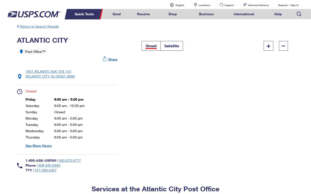
The result verifies the central post-office location and its 08401 label. It does not verify every address that may be associated with that ZIP code.
Atlantic City Postal Labels
USPS assigns delivery geography and post-office labels. A ZIP can include standard delivery, PO boxes, an institution, or nearby places. The city string printed in a mailing address can therefore differ from the municipality in a deed or tax record. That difference is an Atlantic City records issue, not a minor formatting detail. A ZIP match is a weak signal for present municipal identity; a parcel and municipal tax record provide a stronger comparison.
Nearby labels can involve Ventnor City, Margate City, Longport, and Brigantine. Historical material adds another layer: a directory may print South Atlantic City or Longport in a way that was correct for its publication date. Keep the printed label and compare the source date, street, county, municipality, ZIP, and parcel. Do not silently replace a historical label with a current one.
The official Atlantic City post-office result lists 1801 Atlantic Avenue, Suite 101, Atlantic City, NJ 08401-9998, with 609-348-2940 and retail hours of Monday through Friday, 9:00 to 5:00, and Saturday, 9:00 to 12:30. Those details identify that postal facility and its public services. They do not map the full delivery area, establish a municipal line, or confirm an address elsewhere in the ZIP. A current USPS result should always be read as a postal finding with its own access date.
Atlantic City ZIP Code Changes
The 2024 USPS Postal Bulletin reports Atlantic City-related 08405 and 08406 changes that were deleted or realigned toward 08401 in the listed actions. The 2026 Postal Bulletin also lists Atlantic City-related entries for 08401, 08404, 08405, and 08406. Postal bulletins are operational and time-sensitive. They are a reason to check a live address result, not a substitute for it.
This is the useful boundary lesson in the ZIP code directory: the same string can be current in one record and historical in another. Preserve the bulletin year, the source’s city label, and the address date. The research did not capture a stable current USPS polygon or a full official table that validates every address in these ZIPs, so that gap should remain visible rather than filled with a guess.
Atlantic City USPS Search Fields
The USPS historical postmaster finder is useful for postal-history comparisons. It does not establish a parcel boundary or a household connection. The tool captures a range rather than an individual address, and it warns that its database may include current and discontinued post offices. Use it to compare a historical ZIP or post-office relation, then return to a current USPS address lookup and county parcel material for a present question.
| Control | Format or meaning |
|---|---|
| From ZIP | First three ZIP digits for the start of a search range |
| To ZIP | First three ZIP digits for the end of a search range |
| Search | Runs the historical post-office range query |
| Clear | Resets the entered ZIP range |
| Database warning | Results may include current and discontinued post offices |
The USPS postmaster-finder screen supplies this captured view of the ZIP-range controls.
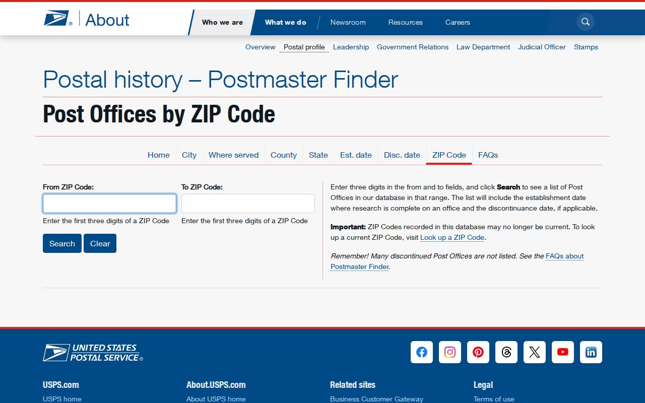
Its discontinued-office warning is why a historical result must be labeled with its period and not presented as a current delivery assignment.
Find Residents by Atlantic City ZIP
No inspected official source provides a complete public resident list keyed only to a ZIP. A ZIP can still narrow an address workflow when each next record is read for its own role. The assessment route connects an address with owner, block, lot, and tax context. GIS offers a ZIP layer and parcel context. The deed index can then search legal town, lot, block, or map number. New Jersey’s controlled voter check is person-based, requiring first and last name with month and year of birth, rather than a ZIP-wide public roster.
- Confirm the current mailing address and ZIP through USPS before relying on the printed city label.
- Open Atlantic County GIS ZIP and parcel layers, preserving the layer name, data date, and disclaimer.
- Use the Board of Taxation route or TaxDataHub to obtain the property’s block, lot, tax-year, and owner context.
- Search the county clerk index by legal town, lot, block, or map number, then compare document and party roles.
- For a person-specific confirmation, use only the official voter or court route that fits the question and record the access date.
Once the address is narrowed, the Atlantic City street directory has the full address-by-address sequence. The ZIP is a geographic filter, not evidence that a name belongs to a household.
Atlantic City ZIP Code Records
The county’s property route matters because it associates a written address with tax and parcel context. The TaxDataHub entry is linked from the county Board of Taxation for property assessment, owner, and sales information. County materials describe assessment and tax-list fields that include owner name, address, block, lot, and assessment. Research did not reliably expose TaxDataHub’s live controls, required flags, coverage date, or representative result. Do not claim a ZIP filter that official inspection did not confirm.
The TaxDataHub page provides this captured reference for the property-search route.
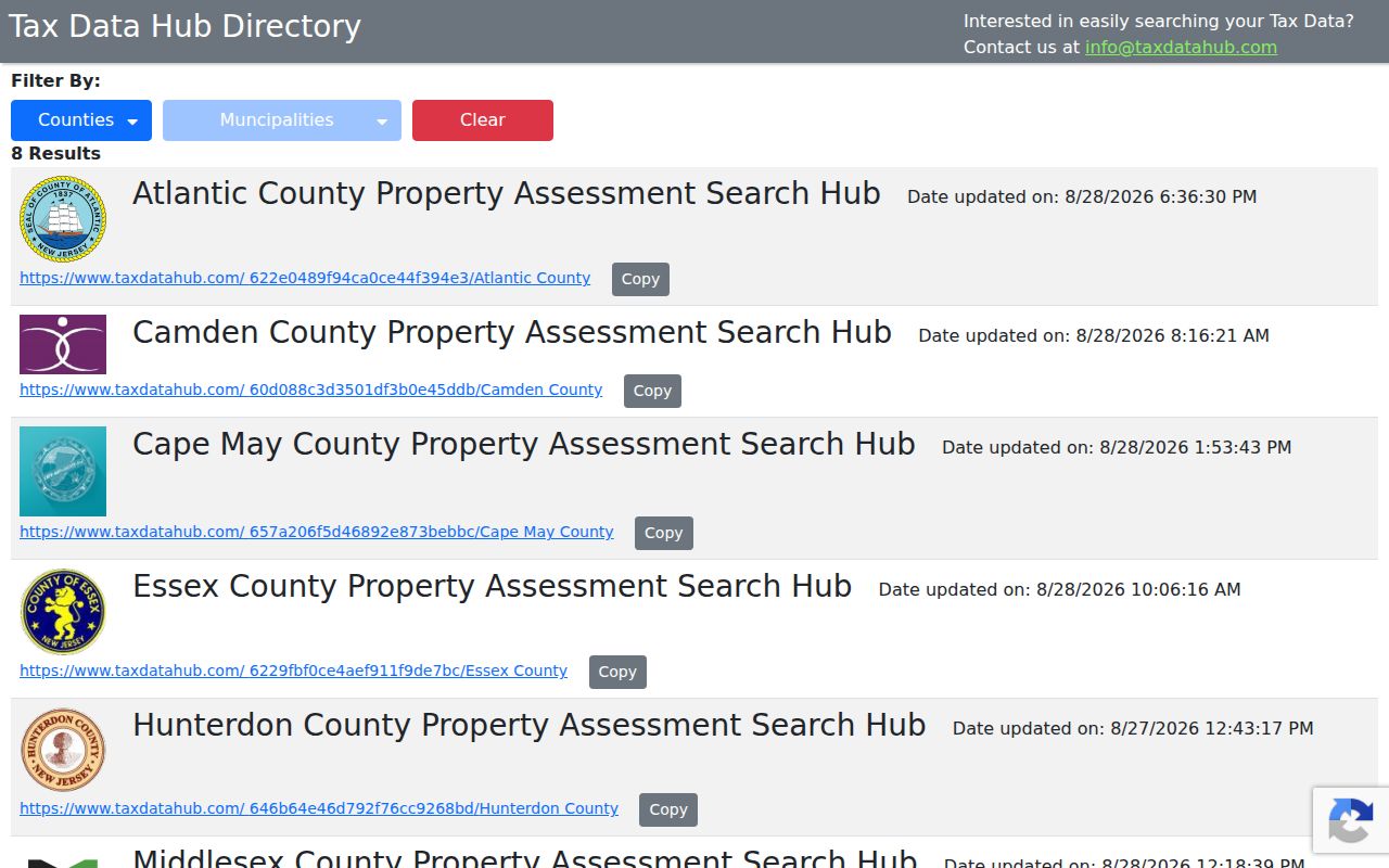
The page can start a parcel inquiry, but its data indicates assessment and owner context for a tax year. It does not identify a current occupant or turn a ZIP code into a resident roll.
ZIP Layers in Atlantic City GIS
The Atlantic County GIS office links a web map viewer, tax maps, shapefiles, static maps, NJGIN, NJ GeoWeb, FEMA, and ZIP boundaries. Its ZIP layer is better visual context than a printed postal city string. Pair it with a parcel layer to locate block and lot, then verify that relationship through the assessor or clerk. This prevents a nearby postal city from being treated as a municipal conclusion.
The county calls GIS data secondary or demonstration material. It is not verified to National Map Accuracy Standards and is not intended for boundary, legal, or precision use. A map can frame the question. A recorded map, tax source, or legal description provides the needed verification.
Atlantic City ZIP Code Terms
Postal terms are easy to confuse with municipal terms. Use these definitions with a source date and full address. They describe how mail is routed, not who lives at a property or which municipality has legal authority over a parcel.
- ZIP code
- A postal routing label that may not match a city limit, ward, neighborhood, or parcel line.
- ZIP+4
- An added four-digit delivery detail. It refines mail routing but is not a municipal boundary.
- PO-box ZIP
- A postal label for post-office box service, not a blanket land-area boundary.
- Unique ZIP
- A ZIP associated with a single institution or special delivery arrangement where USPS assigns one.
- Carrier route
- A postal delivery grouping, not a parcel map or resident list.
Note: A current ZIP result answers a postal-routing question, while deed and tax records answer separate legal and tax-context questions.
Atlantic City ZIP Limits
A postal label does not prove city limits. That is important around Ventnor City and other nearby places, and when reading historical directories with names such as South Atlantic City or Longport. Compare the city string in the record, its date, county, municipality, ZIP, street, and parcel. A historical directory’s wording may be correct for its year even if a current municipal source uses another label.
Boundary check. Confirm an Atlantic City address through current USPS formatting, county parcel context, and a municipal tax or recorded legal source before making a city-limit claim.
Ward maps and neighborhood terms can add civic context, but they are not substitutes for a parcel or municipal record. Retain the source’s geography and date. That approach keeps the ZIP code directory useful without making a postal routing label carry more meaning than it has.
County GIS offers a ZIP-boundary layer for visual context alongside parcel and tax-map layers. Its disclaimer remains important: the information is secondary or demonstration data, is not verified to National Map Accuracy Standards, and is not for boundary, legal, or precision matters. When a mapping layer and a postal label appear to differ, keep both observations, then use the assessor, tax map, clerk record, or survey professional for the question that requires a legal determination.